
Hiking to the summit of Mount Mitchell should be on every hikers bucket list who visits the Appalachian Mountains.

Mount Mitchell is known for being the highest peak east of the Mississippi River coming in at 6,684 feet in elevation.
You’ll find this peak nestled in the Black Mountains, a subrange of the Appalachians, in western North Carolina near Asheville.

Hiking to Mount Mitchell is no easy feat. It’s a 12 mile round trip with over 3,000 feet of elevation gain. So you can prepare for this trek to take an entire day.
There is a road that goes to the summit which is perfect for people short on time or not up for the climb.
However, this guide is for hikers who live for the challenge and thrill of earning the view on foot. If that sounds like you, here’s everything you need to know before hiking Mount Mitchell.
Pin this post for later!

About Mount Mitchell
Mount Mitchell is named after Dr. Elisha Mitchell, a science professor who first measured the elevation and claimed that this mountain was the highest of the Appalachians in the 1830s.
Years later his claim was challenged by Thomas Clingman who believed a nearby peak (what we call Clingmans Peak today) was actually the tallest. This sparked a public dispute over which mountain was actually the highest.
In 1857 Mitchell hiked back to the top of this mountain to reconfirm his measurements and defend his discovery of the highest peak. Tragically, a storm began to roll in and between the rugged terrain and poor weather, he fell off a cliffside to his death.
Despite his tragic end, Mitchell’s calculations were eventually proven correct. The peak he had measured was, in fact, the highest in the eastern U.S. at 6,684 feet. The mountain was officially named Mount Mitchell, a fitting tribute to the man who gave his life proving its height.

Best Time to Hike Mount Mitchell
I would recommend hiking this trail in spring, summer, or fall.
Spring will provide you with nice and cool temperatures and beautiful wildflowers along the trail. Do note that the trail can potentially still have some snow at the higher elevations up until May.
In summer the conditions on the trail are usually great, and all the park services (gift shop, museum, & restrooms) are fully operational.
Although in summer you can run into some afternoon storms which can be dangerous in the case of lightning, especially up on the peak.
I would argue that fall is the best time to hike Mount Mitchell because the weather is amazing with cool and crisp temperatures. Plus, the fall foliage in this region of the US is unmatched. Do note that because of the elevation the peak time for seeing fall color here is going to be late September-mid October.

I hiked Mount Mitchell in late November and unfortunately missed all the foliage at the summit. However, I still had beautiful weather and nice temperatures.
In winter you can expect the trail to be covered in snow, so unless you are prepared with snowshoes and proper gear, I would not advise hiking this trail in winter.
Mount Mitchell Trail Stats
| Mileage | Duration | Elevation Gain | Difficulty |
| 12 miles | 7.5- 8 hours | 3,690 ft. | Hard |
How to Prepare for Mount Mitchell
As you can see from the above stats, this is not an easy or simple hike. It should only be attempted by more experienced hikers who have experience hiking in higher elevations and far distances.
In 6 weeks I trained for Mount Mitchell while hiking about 3 times per week. I went from hiking 2 mile trails at the beginning of my training to 12+ miles at the end.
I began hiking relatively easy trails around DuPont State State Recreational Forest, Pisgah National Forest, and trails off of Blue Ridge Parkway. These hikes ranged from 1-4 miles with no more than 500 feet elevation gain.
After a week or so, I would gradually add on the mileage. AllTrails was a super helpful tool for me during this time in finding hikes around Asheville with the proper amount of mileage and elevation gain for the current place I was at in my training.
By week 5 I was hiking up to 13 miles in one day and ascending around 2,000+ feet of elevation which I feel is plenty for preparing for Mount Mitchell.
So, you do not want to go into this hike without any kind of hiking preparation. You will want at least a month, preferably more of continuous hiking experience in higher elevation environments.

Combating Altitude Sickness
With that being said, it is still possible to get struck with a mild form of altitude sickness on your hike to Mount Mitchell.
The summit sits at 6,684 ft. which isn’t that tall—compared to peaks in the western US where altitude sickness can seriously affect you—but it can definitely happen here too if you’re coming from a very low elevation.
This is especially the case for visitors who opt to drive to the summit instead of hike.
So no matter where you’re coming from, as long as you acclimatize on hikes weeks and months prior, you should be fine on Mount Mitchell.
It may help to have some Tylenol/ Ibuprofen in your bag too to fight off any headaches. And remember to be continuously drinking lots of water throughout the hike.
What to Bring on the Hike
- 3L Hydration pack
- Lunch, snacks
- Sandwiches
- Protein bars
- Trailmix
- Applesauce packs
- Trekking poles
- Sturdy hiking shoes
- Map of trail on phone with plenty battery life
- Small first aid kid
- Band-aids & triple antibiotic
- Gauze
- Tylenol/ Ibuprofen
- Layers of clothing
- Lightweight jacket/ windbreaker
- Breathable long sleeve (or t-shirt in summer)
- Leggings or hiking pants
- Hat & gloves (if hiking in early spring or late fall)
Finding the Trailhead
The trailhead for Mount Mitchell can easily be found via directions on AllTrails and on the map below.
For reference, the trailhead is about 1 hour 15 minutes from Asheville, 1 hour from Marion, and 2 hours 40 minutes from Charlotte.
The trailhead is actually located along Black Mountain Campground, which does have bathrooms you can use.
There is a large gravel lot right across from the campground where you can park to access Mount Mitchell Trail. Parking here is free.
What to Expect Hiking Mount Mitchell
Below I will outline each part of the trek to and from the summit, along with the expected trail terrain.
To the Summit- Started 9 AM
From the trailhead, you’ll follow along a small creek for about a quarter mile before turning onto the actual trail to Mount Mitchell.
This trail pretty much starts off with a bang. No time to ease your way into things. You’ll be going uphill from the get go.
The trail itself for the most part is a nice dirt pathway lined with trees. This hike seems to be pretty well maintained so you won’t have to worry about any overgrown trees or plants.
However, there will be frequent exposed tree roots and rocks throughout this trail. It’s easy to twist your ankle on those so you’ll have to watch your step.

There aren’t very many notable viewpoints along the way, it’s mostly just a long hike through the woods.
However the pine trees and moss do make for a beautiful forest ambiance. Despite the inclines it’s a pretty relaxing hike.
I only ran into a handful of people during my time on the Mount Mitchell Trail. I think since you can drive to the summit most people opt to just drive there instead of hiking.
At the Summit- 12:40 PM
When you come out of the forest, you’ll likely begin to see several tourists. Very different than other summit hikes you may be used to.
You will probably see more people at the summit than you will on the entire 12 mile hike!
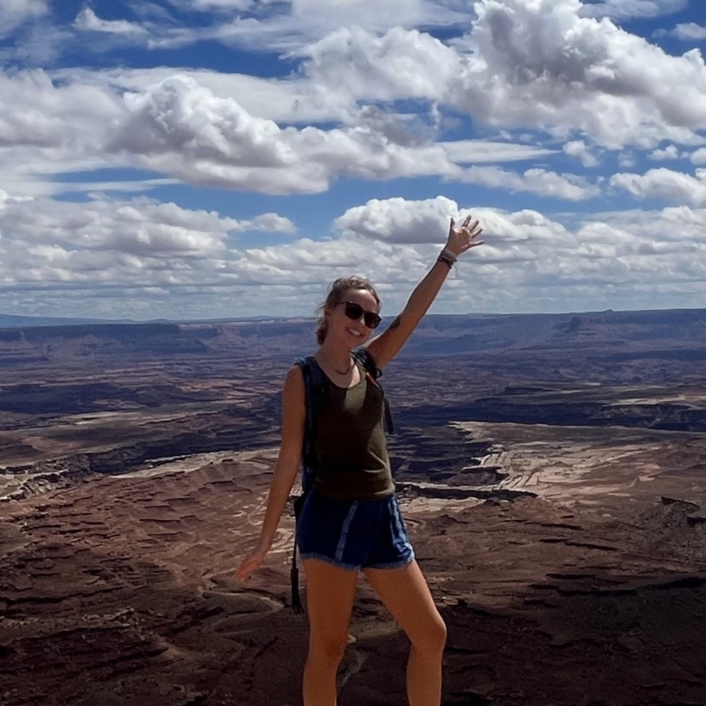
There is a large concrete overlook built at the top (similar but less impressive than Clingmans Dome) where you can get a beautiful 360° view of the surrounding mountains.

You can checkout the museum and gift shop at the top as well, just don’t spend too much time there so you can get back down to the bottom before dark.
Those facilities along with the bathrooms were closed when I went in mid-November, however there are port-a-potties available as well.
Descending to Trailhead- Ended 4 PM
Descending Mount Mitchell may be a little hard on the knees, but it will obviously go a lot quicker and easier than on the way up.
Even though it may not be the most satisfying summit in the world, you are sure to feel a sense of accomplishment after finishing. Especially since this is not a very easy hike, so props to you!
By the time I got back to the trailhead I had about an hour of daylight left. So you definitely want to make sure you begin this hike early in the day.

And that will conclude my guide to the Mount Mitchell Trail in North Carolina! I hope this post helped you better know what to expect on this hike and thank you for reading!


Leave a Reply